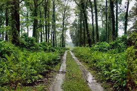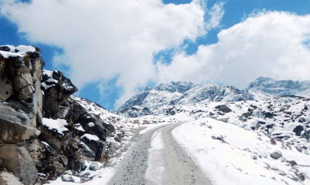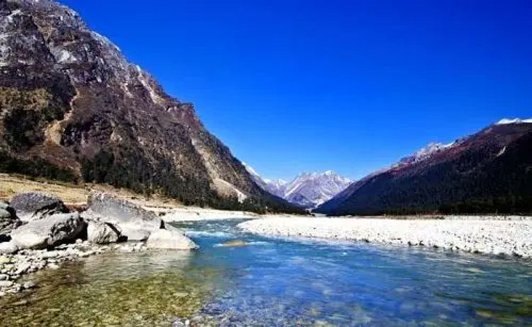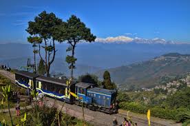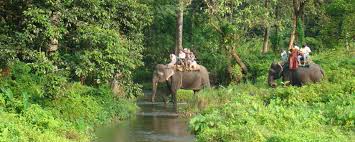
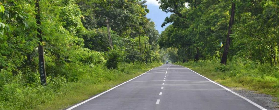
Duars / Dooars Duars or Dooars literally means gateway / door to Bhutan and North East India. Situated in the foothills of Himalaya consisting of an area of 8,800 square kilometer / 3,400 square mile is criss – crossed with rivers. The major river is the Teesta besides many others like the Jaldhaka, Torsha, Murty, Sankosh, Karatoya, Raidak, Kaljani and Dyna. The Duars is spread from Darjeeling foothills to the foothills of Arunachal Pradesh and is known for its rich biodiversity and forests. There are fabulous wildlife sanctuaries with scenic beauty, log huts and Toto Para, the habitat of the rare and smallest surviving tribe known as the Toto. Summer is mild and winters are cold with foggy mornings and nights. Dooars is home to 5 major national park and sanctuary each have their own unique settings. Chilapata forest is near Alipurduar. Jaldhaka is close to Bindu and is a perfect destination for leisure holidays. Neora Valley, Parren Busty, DhupJhora, Kalimati, Kalikapur are some of the offbeat sites and are worth visiting. The amenities are basics, luxury hotels or resorts in Dooars are limited. There are some of the forest watch tower worth visiting like Jatraprasad, Chuk Chuki, Chandrachur Tower, Rhino Point, Chapramari tower etc. Safari are also entertaining along ith Tribal dance which can be arranged on prior notice. Tickets for Safari has to be booked by Guest assisted by our representative. Safari Vehicle is of Government and has to be availed our vehicle will wait outside the sanctuary. There will be a guide in each vehicle for safari. We do not add the cost of Safari as it depends on the availability and guest can decide at spot. Home Stay at Totopara is available with us. Places of interest in Dooars & Siliguri are Baikanthapur Forest, Bodaganj, Sevoke Kali Mandir, Sevoke Coronation Bridge, Iskon Temple at Siliguri, Akshaya Kumar Maytreya Museum, Savin Kindom, Jalpesh Temple, Jatileswar Temple, Bateswar Temple, Mongpong, Mahananda Wild Life Sanctuary, Chuikhim, Rongo, Chapramari Wildlife Sanctuary, Gorumara Tents (A Nature Study Centre), Gossaihat Nest, Jhalong, Bindu, Paren, Todey, Tangta, Kalipur, Khuntimari Forest, Lataguri – Gorumara National Park, Neora Jungle Camp, Panjhora, Chalsa, Rocky Island, Samsing, Chilapata Forest, Dhumchi Forest, Garuchira, Jayanti – Buxa Tiger Reserve, Kunjanagar, Malongi, Nilpara, Raja Bhatkhawa, Rangamati, Khairbari Leopard rescue centre, etc We do bookings for Dooars hotels along with the packages. We even help book Resort or Hotels at Dooars for Corporate and School group. Booking with food or without food is done by us as per the choice of our guest. Hotels or resort in Dooars have their own restaurant. On request we carry or set up our own kitchen in the restaurant as per the request of our guest. Dooars in Hotels at Dooars are standard and only few have star accommodations. It is advisable to guest that resort with less number of Rooms and isolated are best choice. Hotels at Dooars / Duars, forest rest house in Dooars, Resort at Dooars / Duars are booked by us at various locations. Forest Bungalows or lodges are booked three to four months in advance as this are in demand through out the year. Forest safari is closed in Tiger reserve by government of India. Jungle Safari remains closed from 15th June to 15th September each year. Forest Safari tickets are issued only to Guest. Hence we arrange for the transfer, stay and excursion in Dooars. For Safari our representative will help you for ticket booking and the Safari. Each destinations in Dooars has its own beauty Raimatang, Nimati, Nilpara, Chilapata, Kodalbosti, Totopara, Samsing, Suntalekhola, Bindu, Jaldhaka, Parren Basti, Falakata, Bodaganj, Ambari, Kathambari, Odlabari, Rajabhatkhawa, Buxa Tiger Reserve, Buxa Duar, Jayanti, Bhutan Ghat, Raseekbill, Khuttimari, Jalpesh, Murti, Cooch Behar, Alipurduar, Mongpoo, Hollong, Jaldapara, Gorumara National Park, Lataguri, Neora Valley Red Panda Camp, Chapramari Wildlife Camp, Chilapata Camp, Gurumara (East) Elephant Camp or Dhupjhora are some of the tourist hot spot. Hotels and resort in Chalsa – Lataguri – Chapramari – Jhalong – Bindu – Jaldapara – Buxa are booked by us. It has small quiet ethnic villages, vast tea gardens and stretches of grassland. There are a few ethnic groups / tribes, including the Bodo of Assam, the Rabha, the Toto, the Koch, Limbus, Lepcha, Bhutanese, Oraons, Mundas, and the Rajbongshis in Bengal. It is mostly covered with national parks, wildlife sanctuaries and Tea gardens. Forests in Dooars are Buxa Tiger Reserve, Chilapata and Chapramari. Gorumara and Neora Valley National Park is the two major wildlife centers. There are six wild life sanctuaries and National Parks in this region. Jaldapara and Buxa are famous for tourist footfalls. Bison and Elephant herd, one horned Asian Rhino, Leopard, Spotted Deer, Sambar, Hog Deer, Reptiles, and wild Boars are some of the mammals. Several rare and endangered species of animals have their habitats in the Dooars; it is also known for its avifauna and range of flora. Dooars / Duars hotel bookings is done by us. Chalsa – Lataguri – Gorumara – Chapramari – Jaldapara hotels and resorts are booked by us at cheaper rates. budget hotels and resorts to the luxury hotels and resorts in Duars / Dooars are booked well in advance through us. Lataguri hotels and resorts have many options but at Jaldapara government lodges and rest houses are booked at least 2 months in advance due to its demand. Hollong stay is booked at least two months in advance and in peak seasonin earliest possible time. Communication / Connectivity Airways – The nearest airport is at Bagdogra, which is 2 to 3 hours drive from Duars / Dooars. Bagdogra airport (IXB) is well connected to Kolkata, Delhi and Guwahati with daily flights. One can avail the airways with two to three hours drive. It is well connected with roads and railways with the neighboring places. Even Paro airport in Bhutan is also 7 to 8 hours drive. Railways – New Jalpaiguri railway station-NJP- is the major junction. Though railway is not popular as a mode of transport in the area, yet there are a few railway station and the track passes through scenic sites. Important stations like Rajabhatkhawa, New Cooch Behar, Alipurduar and Chalsa. A scenic rail route between Alipurduar Junction and New Jalpaiguri via Malbazar covers almost entire Dooars region but it is in news as 10 elephants have been killed by speeding train in the last couple of years. Roadways – The main mode of transport in the area is roadways and is well connected to the rest of India. National Highway 31 is the main highway passing through Duars. Regular bus services provided by North Bengal State Transport Corporation and Assam State Transport Corporation and other private vehicles are also available, except during tourist season, when it is to be booked prior. Gorumara is 75 kilometers from Siliguri, Chapramari is 68 kilometers from Siliguri, the Buxa Tiger Reserve is 200 kilometers from Siliguri and the Jaldapara is 124 kilometers from Siliguri. Places of Interest GORUMARA NATIONAL PARK, CHAPRAMARI, Buxa Tiger reserve, / Buxa Duar Neora valley, JAYANTI, RAJABHATKHAWA BINDU/JALDHAKA/JHALONG SAMSING – SUNTALEYKHOLA RASIKBILL COOCHBEHAR DHUPJHORA CHILAPATA/RAIMATANG BHUTANGHAT JALDAPARA WILDLIFE SANCTUARY.

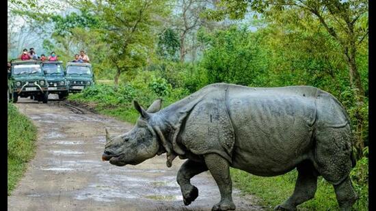
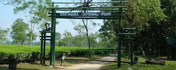
Gorumara National Park complete detail – updated. Geography of Gorumara National Park. Dominant flora and fauna of Gorumara National Park. How to Reach Gorumara National Park. Gorumara Park located on the bank of rivers Murti and Raidak has vegetation of riverine grasslands interspersed with savannah woodlands. Much of this forest is moist deciduous and sal is the most common and valuable tree. Teak, Simul, Siris, Khair are also found here. The park is breathtaking with its rivers and mountain ranges. The park has been declared as the best among the protected areas in India by the MOEF (Ministry of Environment and Forest) for the year 2009. The park is home to many species flora and fauna. The vegetation here is so thick that sunlight barely reaches down to the forest floor and there are times when it is impossible to see through the thicket…………… Total area of the park is 79.45 Km2. It was established as a National Park in the year of 1992. The park is home to mammal species like One horned rhinoceros, Indian Elephant, Indian Bison, leopard, Deer, Sambar, Monkeys etc. The National park has now become a prime tourist attraction due to the magnificent forests, breathtakingly beautiful landscapes and the presence of the Indian Rhinoceros. National park is an area which is strictly reserved for the betterment of the wildlife & biodiversity, and where activities like developmental, forestry, poaching, hunting and grazing on cultivation are not permitted. Their boundaries are well marked and circumscribed. Gorumara National Park is a beautiful place, located in the Jalpaiguri district of the state of West Bengal. The park is situated in the Terai region of the Himalayan foothills. It is primarily known for its population of Great Indian One horned Rhinoceros. It was established as a National Park in the year of 1992. Total area of the park is 79.45 Km2. Gorumara Park located on the bank of rivers Murti and Raidak has vegetation of riverine grasslands interspersed with savannah woodlands. The park has been declared as the best among the protected areas in India by the MOEF (Ministry of Environment and Forest) for the year 2009. The park is home to many species flora and fauna. The vegetation here is so thick that sunlight barely reaches down to the forest floor and there are times when it is impossible to see through the thicket. The park is home to mammal species like One horned rhinoceros, Indian Elephant, Indian Bison, leopard, Deer, Sambar, Monkeys etc. The park also provide suitable habitat to bird species Indian pied hornbill, Woodpeckers, Sunbird, fly catcher, Minivet, Drongo, Brahminy duck, Pheasants and many more migratory birds. Lataguri a small town adjacent to the park is the entry point. There are watch towers for viewing the animals inside the park. They are Jatraprasad Watch tower (named in memory of a legendary elephant of that name), Rhino observation point in front of the Gorumara forest bungalow, Old Khunia Watch Tower near the Murti forest bungalow and Suksukia Bird watching Point. Rhino observation point is the best place to observe wild animals like rhino, elephant, bison and deer as they regularly come to the salt reservoir just below the tower. The National park has now become a prime tourist attraction due to the magnificent forests, breathtakingly beautiful landscapes and the presence of the Indian Rhinoceros. History Since 1895 it was a Reserve Forest. Bungalow of Park Forest dates to old British Raj period, & has a quite preserved register book from its beginning, which creates for attractive reading. Nevertheless Gorumara is surrounded by several ethnic villages. More than 10,000 resident forest villagers derive their income from sources including employment in forest department activities, ecotourism, etc. Some of the villages are Sarswati, Budhuram, Bichabhanga, Chatua, Kailipur and Murti Forest Village. It was declared a Wildlife Sanctuary in the year of 1949. Gorumara was declared a National Park in the year of 1992. Total area of the park is 79.45 Km2. This area has undulating forests & riverine grasslands, & is famous as the Dooars in West Bengal. Gorumara National Park is situated on the flood plains of the River Murti & River Raidak. The main river of the Gorumara National Park is the river Jaldhaka, a branch of the river Brahmaputra scheme. Geography Gorumara National Park is located in the Jalpaiguri district of the state of West Bengal. The park is situated in the Terai region of the Himalayan foothills. Gorumara Park located on the bank of rivers Murti and Raidak has vegetation of riverine grasslands interspersed with savannah woodlands. The vegetation here is so thick that sunlight barely reaches down to the forest floor and there are times when it is impossible to see through the thicket. Much of this forest is moist deciduous and sal is the most common and valuable tree. Teak, Simul, Siris, Khair are also found here. The park is breathtaking with its rivers and mountain ranges. The arid deciduous jungle terrain mix together with grasslands, docks one of biggest variety of jumbo fauna in West Bengal. The major river of the park is the Jaldhaka River, a tributary of the Brahmaputra river system. In this regard, Gorumara is a significant watershed area between the Ganges and Brahmaputra river systems. The park is very close to Jaldapara National Park and Chapramari Wildlife Reserve. Dominant flora Sal, Bamboo, Teak, Simul, Siris, Khair, and Savanna grass etc. The vegetation here is so thick that sunlight barely reaches down to the forest floor and there are times when it is impossible to see through the thicket. Dominant fauna Mammals – Indian rhinoceros, Gaur, Sloth bear, Deer, Sambar, Asian elephant, Wild boar, Hog deer, Barking deer, Leopard, Tiger, Indian wild dogs, Indian wolves, Giant squirrels, Pygmy Hog, Hispid Hare etc. Birds – Scarlet Minivet, Sunbird, Asian paradise flycatchers, Spangled drongo, Indian hornbill, Woodpeckers, Pheasants, Peafowls, Brahminy duck etc. Reptiles – Indian python, Indian cobra, King cobra, Lizards etc. Other Attractions Ethnic Forest Village Tourism Nature Interpretation Centre Jatraprasad Watch Tower Rhino Observation Point Chandrachur Watch Tower Chukchuki Bird-watching Point Best Time to Visit The best time of the year to visit the Gorumara National Park is between the months of October to May. The park remains closed from 16th June to 15th September. Communication By Air – Nearest airport is Bagdogra airport, about 80 Km from the Gorumara National Park. Bagdogra airport is well connected by road network to Gorumara National Park. By Rail – Nearest railway station is New Maynaguri railway station, about 20 Km from the Gorumara National Park. New Maynaguri railway station is well connected by road network to Gorumara National Park. By Road – Gorumara National Park is well connected to Major Cities and Places by road network. There are a number of government and privately operated vehicles that go to Gorumara National Park at frequent intervals. National Highway 31 which connects Siliguri and Guwahati passes through Lataguri
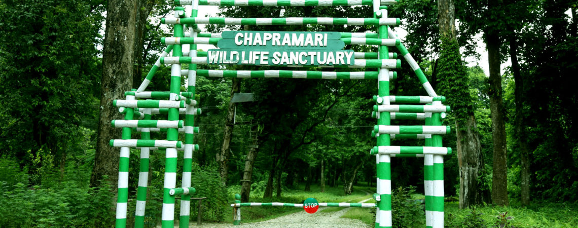
Chapramari Wildlife Sanctuary (formerly Chapramari Wildlife Reserve, is close to the Gorumara National Park. Chapramari is about 30 kilometres from Chalsa and Lataguri in northern West Bengal, India. The total coverage of the forest is 960 hectares History In 1896, an imperial forest-service administrator D.H.E. Sander first sent a proposal to the-then English-dominated Government of India that Chapramari could be developed into a tourism centre. The area was declared a national reserve forest in 1895 under the Indian Forest Act. In 1939, the name Chapramari Wildlife Reserve came to be used, while the Government of India, in 1998, gave it the status of a national wildlife sanctuary. The name of the region comes from ‘Chapra’, a variety of small fishes found in northern Bengal, and ‘Mari’, meaning ‘abundance’. Chapramari receives waters from the Teesta, the Neora, and the Murti. Wildlife A large variety of flora and fauna are found in the forests. Chapramari is known for its elephant population. Gaur (commonly known as Indian bison) are not uncommon in the Chapramari region. Deer, boars, and leopards are also found there.However like Gorumara Royal Bengal Tiger are not found here. The place is popular with bird watchers, with parakeets, kingfishers, and green pigeons found in abundance. In 2009, a marauding leopard was captured in Dooars and released into Chapramari. Communication Malbazar Rail Station is the closest rail hub. Chapramari is located around two hours’ drive from Siliguri, the principal city in northern Bengal. The access from Jalpaiguri passes through the dense forests of Batabari range. Due to complications caused by monsoons, the wildlife sanctuary remains closed each year from 16th June to 15th September.
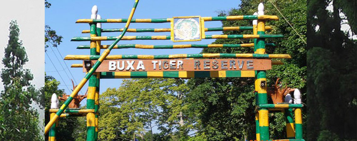
Buxa Tiger Reserve (B.T.R.) is situated in Alipurduar Sub-division of Jalpaiguri District, West Bengal. It comprises of the entire erstwhile Buxa Forest Division (702.44 km2), and a part of Cooch- Behar Forest Division (58.43 km2). The Reserve lies between latitudes 26o30′ and 26o55′ N and longitudes 89o20′ and 89o55′ E. The Forest Department in the year 1866 took over the forests of Buxa Tiger Reserve and prior to that these used to be an unoccupied wasteland. Those forests came under British rule in 1865 and the first reservations were made in 1879 according to the Indian Forest Act (Act VIII of 1878) and the process continued till 1940. Thus most of the forest areas of the Tiger Reserve enjoy the status of reserved forests under the provision of the Indian Forest Act (IFA), 1927 up to 1982. BTR was constituted in the Year 1983 in Jalpaiguri District vide Govt. of India’s notification No. J-11025/18/B/FRY (PT) dated, 16th February, 1983 and became the 15th Tiger Reserve of the Country. Buxa Tiger Reserve was formed over an area of 758.78 Sq. Km of reserved forests vide Govt. of India’s notification No.J-11025/18/B/FRY (PT) dt.16-02-1983. District Magistrate, Jalpaiguri transferred 209.84 Ha resumed tea garden forest lands Vide memo no. 346(10)/LR-C dt.15.05.89 for inclusion in BTR. Thus, the total area of BTR is 760.87 km2. An area of 314.52 km2 was declared as Buxa Wildlife Sanctuary vide Notification No.316-For/11B-1/86 dated. 24-01-1986 under section 18 of Indian Wildlife Protection Act, 1972. Subsequently, Collector/ Jalpaiguri carried out proceedings for settlement of rights and concessions under section 19 to 25 of said Act and declared that no rights of anyone exists over an area of 331.60 km2 of Buxa Wildlife Sanctuary vide his memo No.346(10)/ LR-C dt.15-05-1989. Thus an area of (331.60 – 314.52) or 17.08 Km2 is yet to be Notified as Sanctuary by the Govt. of West Bengal. Field Director/BTR had communicated the matter vide his memo No.1260/28-42 dt. 18-09-91 to the Conservator of Forests, WL circle/ WB for taking necessary action from his end so that a corrected notification would come. In the year 1990, an additional area of 54.47 km2was added to the Sanctuary vide Notification No.7588-For/11B-24/90 dt. 06-10-90 and 12-For/11B-24/90 dt. 01-01-91 under section 18(1) of Wildlife Protection Act, 1972 making the Sanctuary area of total 386.07 Sq. Km. Settlement proceedings by the District collector in respect of 54.47 km2 are yet to be completed under section 19 to 25 of the said Act. In 1992 an area of 117.10 km2 of the Sanctuary was preliminarily notified as National Park under section 35(2) of Indian Wildlife Protection Act,1972 vide notification no.85-For/11B-42/91 dt 06-01-92 and finally constituted as Buxa National Park vide Notification No.3403-For/11B-6/95 dt. 05-12-1997, under section 35(4) of the said Act. BTR stretches over a length of 50 km. from west to east and 35 km. from north to south. The total area of the Reserve is 760.87 km2. of which 386.07 km2. has been constituted as Wildlife Sanctuary and National Park and the balance 374.80 km2area as Reserved Forests and Other Protected Forests. The total core area of Buxa Tiger Reserve is of 390.581 sq. km. Ecotourism Core Area The core area except the permissible small areas as mentioned below is kept out of the Tourism zone. However, three areas in the core area would be open for the tourists in a regulated manner for religious and educational purposes. Mahakal cave:This ancient Lord Shiva’s pilgrimage site lies in Bhutan. Every year thousands of tourists visit this place. Considering its religious importance transit to this site is provided through the core area only through the Jainty River Bed which is usually dry during the pilgrimage months. Narathali Beel:This is a natural wetland. Every year thousand of winter birds visit the area. Since it lies on Core-Buffer boundary this wetland would be opened for the tourists only during winters for two months up to watch tower. Tourist facility would be created at Beat Office compound. Jayanti Pokhri:This small wetland on high altitude is home to several species of fish and turtles. The trek from Jainty to Pokhri passes through beautiful forest. This site lies close to the Core-Buffer boundary. Tashigaon Watch Tower on way would be allowed for the tourists to have an exposure about duty of staff within Core forests, maintenance of water holes and glades, creation of fodder plantations. This would be as part of Nature Study and generation of awareness about Wild Life of the area. Buffer Area Ecotourism is being carried out within a limited area of the Reserve for the present. The Department of Tourism, Govt. of West Bengal has included B.T.R. within the tourist circuit. Presently the main tourist attractions are places scattered all over the East and West Divisions, namely Jainty, Buxaduar, Bhutanghat, Rajabhatkhawa etc. Though, tourists visit this Reserve mainly for nature and adventure tourism and the main focus is on wildlife tourism, difficulty in sighting of wild animals due to dense vegetation and lack of grasslands means that there is a substantial faction of recreational and religious devotion based tourism which also takes place in the core of BTR. Commercialization of tourism within BTR is not compatible with its main objective of protecting bio-diversity of the area. But restricted tourism in the form of nature education tour and eco-tourism help to the people appreciates the need for preserving wilderness values. An enlightened nature tourist is an ally in the cause of bio-diversity conservation. Along with the regular tourists, BTR also attracts considerable number of picnickers from nearby areas in Jainty, Hatipota, and Kumargram blocks. Day visitors are generally local people, with school children coming in groups. Most day visitors go up to Rajabhatkhawa, visit Nature Interpretation Centre (NIC) and Rescue Centre. Tourism Zone in Buffer: Jainty Bazaar – The Jainty River and its surrounding hills present a breath taking scenic beauty. The tourists visit Jainty both as day visitor and as halting camp. Buxa Duar – The ruins of Buxa Fort is major tourist attraction. The fort is about 3 Kms from the nearest road head. The trekking to fort passes through hills and is full of scenic beauty. Rajabhatkhawa – The place is popular among tourists. The Nature Interpretation centre, Rescue centre, Vulture Breeding Centre, Nature Trail, Forestry Training Centre is major attractions. A Butterfly Park is proposed here. Poro North and South Eco Parks – The places are very popular centre for picnicking, family gathering, boating and enjoying the natural beauty of Forests. The spot is located on the bank of Poro River. Trek to Jainty Pokhri – This small wetland on high altitude is home to several species of fish and turtles. It’s an ancient Holy wetland and revered by Buddhists and Tribals. The trek passes through beautiful forest. Sikiajhora – The place is on bank of a perennial stream originating from Buxa Forests. Number birds visit the area every year. There is a watch Tower for bird watching which can be improved. The place is already a popular spot for pick nicking. Boating facility can be added. Narathali Beel– There is a natural wetland. Every year thousand of winter birds visit the area. Garam – Dima Nature Observation Tower – The watch tower on the bank of Dima River and vast overlooking Grassland along with a very good view of Buxa Forest, Buxa & Bhutan Hills makes this spot picturesque. Near by Places of Tourist Attraction Rajbari of Cooch-Behar – The old Palace of Cooch Behar rulers is a beautiful building. Kholta Eco Park – This is small deer park, about 10 Kms from Alipurduar. Toy train and an Eco park add to the attraction. Baneswar Temple– This old temple is very popular among habitants of Alipurduar and Cooch Behar. Jaldapara Wild Life Sanctuary – Its about 40 Kms from Damanpur. Patlakhawa Wetlands – It’s about 25 Kms from Alipurduar and is a big attraction during winters due to advent of Himalayan Migratory Birds. Flora & Fauna The Flora : BTR has a wide range of flora owing to a range of natural parameters like topography, climate, temperature and rainfall. It represents several elements of biodiversity of North-East India and Indo Malayan region, one of the most bio-diverse Indian regions. Around 60% of floral endemic species of NE India are encountered in BTR. It possesses around 1,000 floral species including over 100 species of medicinal plants. Forest Type : 1 : Riverine Forests 2 : Sal Forests 3 : Dry Mixed Forests 4 : Wet Mixed Forests 5 : Semi Evergreen Forests 6 : Evergreen Forests 7 : Hill Forests 8 : Savannah Forests The Tiger Reserve has a spectacular range of faunal variety. It harbour over 1,000 faunal species including endemic Indo-Malayan species like Chinese Pangolin, Reticulated Python and some endemic species of North-East Indian zone like clouded leopard, Marble cat, Black Necked Crane. The Fauna : 1) Mammals : 68 species of mammals are reported in BTR. Felines : Tiger, Leopard, Clouded Leopard, Marble Cat, Leopard Cat, Fishing cat Canines : Wild Dog, Jackal, hyena Primates : Rhesus Macaque Rodents : Indian Giant Squirrel, common Hare, Porcupine Hoofed animals : Bison, Sambar, Spotted Deer, Barking Deer, Hog deer Pachyderm : Elephant 2) Reptiles, Amphibians & Fishes : Snakes : King Cobra, Cobra, Reticulated Python, Krait, Vipers etc Lizards : Common Monitor Lizard, Garden Lizard, Gecko, Skink etc Amphibians : Common Indian Toad, Indian Bull Frog, Indian Skipper, Rice Field Frog Fishes : Boal, Kalbus, Mrigel, Chital, Sole etc Near by Places of Tourist Attraction Rajbari of Cooch-Behar – The old Palace of Cooch Behar rulers is a beautiful building. Kholta Eco Park – This is small deer park, about 10 Kms from Alipurduar. Toy train and an Eco park add to the attraction. Baneswar Temple– This old temple is very popular among habitants of Alipurduar and Cooch Behar. Jaldapara Wild Life Sanctuary – Its about 40 Kms from Damanpur. Patlakhawa Wetlands – It’s about 25 Kms from Alipurduar and is a big attraction during winters due to advent of Himalayan Migratory Birds. Communication :- The Head quarter of Buxa Tiger Reserve is located at Alipurduar Town. The nearest Broad-gauge railway station (New Alipurduar) is located at the out skirts of the town. Alipurduar is linked by train to Delhi, Kolkata and Guwahati. The town is on the broad gauge line of the North -East Frontier Railway connecting Siliguri and Guwahati. The Reserve can be approached by road (30 Km.) from Cooch Behar. The nearest airport is at Bagdogra near Siliguri (175 Km. away). Bagdogra is connected to Delhi, Kolkata and Guwahati by air. From Siliguri, Alipurduar can be approached by train (broad-gauge) or by road. Alipurduar is 720 Km away from Kolkata by train. There are a number of direct trains from Kolkata and Delhi to Alipurduar.
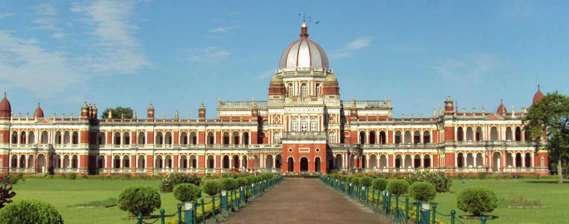
Cooch Behar is the district headquarters of the Cooch Behar District in the Indian state of West Bengal. It is in the foothills of the Eastern Himalayas at 26°22′N 89°29′E. Cooch Behar is the only planned town in North Bengal region with remnants of royal heritage.One of the main tourist destinations in West Bengal, it is the location of the Cooch Behar Palace and Madan Mohan Temple and has been declared a heritage town. It is the maternal home of Maharani Gayatri Devi. During the British Raj, Cooch Behar was the seat of the princely state of Koch Bihar, ruled by the Koch dynasty of Assam. After 20 August 1949, Cooch Behar District was transformed from a princely state to its present status, with the town of Cooch Behar as its headquarters. The name Cooch Behar is derived from the name of the Koch or Rajbongshi tribes indigenous to this region for many centuries.[4]The word behar is derived from Sanskrit: विहार vihara. History Early period Cooch Behar formed part of the Kamarupa Kingdom of am Assam from the 4th to the 12th centuries. In the 12th century, the area became a part of the Kamata Kingdom, first ruled by the Khen dynasty from their capital at Kamatapur. The Khens were an indigenous tribe, and they ruled till about 1498 CE, when they fell to Alauddin Hussain Shah, the independent Pathan Sultan of Gour. The new invaders fought with the local Bhuyan chieftains and the Ahom king Suhungmung and lost control of the region. During this time, the Koch tribe became very powerful and proclaimed itself Kamateshwar (Lord of Kamata) and established the Koch dynasty. The first important Koch ruler was Biswa Singha, who came to power in 1510 or 1530 CE. Under his son, Nara Narayan, the Kamata Kingdom reached its zenith. Nara Narayan’s younger brother, Shukladhwaj (Chilarai), was a noted military general who undertook expeditions to expand the kingdom. He became governor of its eastern portion. After Chilarai’s death, his son Raghudev became governor of this portion. Since Nara Narayan did not have a son, Raghudev was seen as the heir apparent. However, a late child of Nara Narayan removed Raghudev’s claim to the throne. To placate him, Nara Narayan had to anoint Raghudev as a vassal chief of the portion of the kingdom east of the Sankosh river. This area came to be known as Koch Hajo. After the death of Nara Narayan in 1584, Raghudev declared independence. The kingdom ruled by the son of Nara Narayan, Lakshmi Narayan, came to be known as Cooch Behar. The division of the Kamata Kingdom into Koch Behar and Koch Hajo was permanent. Koch Behar aligned itself with the Mughal Empire and finally joined the India as a part of the West Bengal, whereas remnants of the Koch Hajo rulers aligned themselves with the Ahom kingdom and the region became a part of Assam. As the early capital of the Koch Kingdom, Cooch Behar’s location was not static and became stable only when shifted to Cooch Behar town. Maharaja Rup Narayan, on the advice of an unknown saint, transferred the capital from Attharokotha to Guriahati (now called Cooch Behar town) on the banks of the Torsa river between 1693 and 1714. After this, the capital was always in or near its present location. In 1661 CE, Maharaja Pran Narayan planned to expand his kingdom. However, Mir Jumla, the subedar of Bengal under the Mughal emperor Aurangazeb, attacked Cooch Behar and conquered the territory, meeting almost no resistance. The town of Cooch Behar was subsequently named Alamgirnagar. Maharaja Pran Narayan regained his kingdom within a few days. British Raj In 1772–1773, the king of Bhutan attacked and captured Cooch Behar. To expel the Bhutanese, the kingdom of Cooch Behar signed a defence treaty with the British East India Company on 5 April 1773. After expelling the Bhutanese, Cooch Behar again became a princely kingdom under the protection of British East India company. The Victor Jubilee Palace was based on Buckingham Palace and built in 1887, during the reign of Maharaja Nripendra Narayan. In 1878, the maharaja married the daughter of Brahmo preacher Keshab Chandra Sen. This union led to a renaissance in Cooch Behar state. Maharaja Nripendra Narayan is known as the architect of modern Cooch Behar town. Post Independence Under an agreement between the kings of Cooch Behar and the Indian Government at the end of British rule, Maharaja Jagaddipendra Narayan transferred full authority, jurisdiction and power of the state to the Dominion Government of India, effective 12 September 1949. Cooch Behar District was forcefully separated from Assam and made a part of West Bengal even Goalpara district of Assam was forced to join West Bengal. Eventually, Cooch Bihar became part of the state of West Bengal on 19 January 1950, with Cooch Behar town as its headquarters. Popular festivals in Cooch Behar include Durga Puja in October, along with Ras Purnima, when a big fair is organised near the famous Madan Mohan Temple. Cooch Behar Ras mela is the oldest in the North Bengal region. Other major festivals celebrated in the region include Pohela Baishakh (Bengali New Year), Rathayatra, Dolyatra or Basanta-Utsab, Diwali, Poush parbon (festival of Poush), Christmas, Eid ul-Fitr and Eid ul-Adha. During Rathayatra, a small fair is organised at Gunjabari area of the town. Culture Every year during the Ras Purnima, the city hosts Ras Mela, the largest and oldest fair of West Bengal.The fair is older than 200 years.The fair is organised by Cooch Behar Municipality in the Ras Mela ground near ABN Seal College.During the fair, it becomes a major economical hub of the whole North Bengal region.Merchants and sellers from all over India and also from Bangladesh join this fair.Earlier the Maharajas of Cooch Behar inaugurated the fair by moving the Ras Chakra and now the work is executed by the District Magistrate of Cooch Behar District.The Ras Chakra is considered as a symbol of communal harmony because it is made by a Muslim Family from generations.A huge crowd gather in Cooch Behar from neighbouring Assam, Jalpaiguri, Alipurduar and whole North Bengal during the fair. Cooch Behar has a mixture of cultures, similar to those of West Bengal and Bangladesh. Rice and fish are traditional favourites, leading to a common saying that “fish and rice make a Bengali” (machhe bhate bangali). Meat consumption has increased with higher production in recent years. Bhuna Khicuhri (a dish made of rice and dal) and labra (a fully mixed-vegetable preparation) are quite popular and are served during any religious occasion. As in any part of West Bengal, people of Cooch Behar are known to prepare distinctive confections from milk products; popular ones are Rôshogolla, Chômchôm Kalakand Sandesh Misti Doi and Kalojam. Bengal’s vast repertoire of fish-based dishes includes various hilsa, ilish preparations (a favourite among Bengalis). Fast foods, such as Paratha (fried bread), egg roll (flatbread roll with vegetable stuffings and egg), and phuchka (deep fried crêpe with tamarind and lentil sauce) are widely popular. The momo is another popular snack made from vegetable or meat filling, which is steamed and served with a soup. Another popular snack is Ghatigaram, a variety of Jhalmuri (a mixture made out of flattened rice and other spices). Bengali women commonly wear saris (shaŗi) and the salwar kameez, which are distinctly designed as per local customs. However, Western-style attire is also quite popular, especially amongst youngsters. Men wear traditional costumes such as the kurta with dhoti or pyjama, often on religious occasions. A characteristic feature of Cooch Behar is the para or neighbourhoods with a strong sense of community attachment. Typically, every para has its own community club with a clubroom and often a playground. People here habitually indulge in adda or leisurely chat, and these adda sessions are often a form of freestyle intellectual conversation. Residents of Cooch Behar are fond of music and generally listen to Rabindra Sangeet, Bengali bands, Hindi pop music and the local Bhawaiya Sangeet. The local Bengali dialect, is different from the one spoken in Kolkata. It is closer to that of East Bengal and a mix of Assamese and Rajbangsi language. The Cooch Behar Palace Museum has photographs and articles used by the maharajas of Cooch Behar and information about the tribals of North Bengal. The Railway Heritage Museum at Cooch Behar station displays historical documents and objects from the Cooch Behar State Railway, Eastern Bengal Railway, Bengal Dooars Railway.[28] The town boasts a well-archived North Bengal State Library. Rabindra Bhawan, an auditorium, is often chosen as the venue for cultural events such as dramas, concerts, poetry-recitals, and dance programs. Temples exist throughout region; the Madan Mohan Temple, Madhupur Satra, Bara Debi Bari and Rajmata Temple are centres of religious and cultural importance. Novelist Amiya Bhushan Majumdar was born, brought up, and worked in Cooch Behar. Cooch Behar with its people, culture, and the river Torsha were a recurrent theme in his novels. Communication Trains offer the most convenient option to reach Cooch Behar from other cities in the country. There are no direct flights to Cooch Behar but buses are available from nearby cities. By Flight Cooch Behar has its own airport which is currently dysfunctional, Bagdogra Airport near Siliguri is the nearest airport. Bagdogra receives flights from the major cities of India and is an important airport linking North East to the country. Nearest Airport: BAGDOGRA – 121 kms from Cooch Behar By Road Extremely well connected by road to the nearby cities. State tourism buses run at a regular interval to and from the town along with private buses which help in increasing connectivity. By Train New Cooch Behar is the nearest station, having direct trains from the key cities of the country and connected trains from others. Just 5 km away from the main town, rickshaws and cabs can be boarded from here to Cooch Behar.
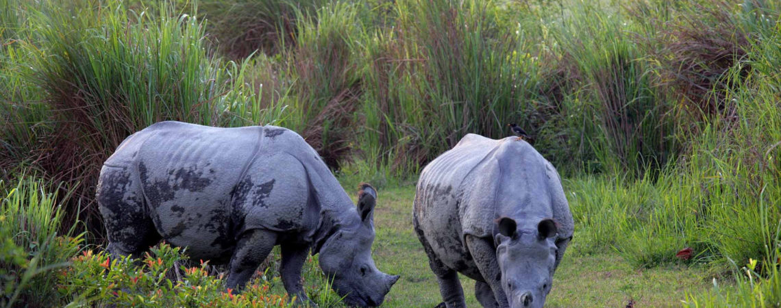
Jaldapara Wildlife Sanctuary is situated at the foothills of Eastern Himalayas in Alipurduar Sub-Division of Jalpaiguri District in West Bengal. The river Torsha flows through this rain forest sanctuary and have an area of 141 Sq.km and altitude of 61 m. Jaldapara, the vast grassland with patches of riverine forests was declared a sanctuary in 1941 for protection of the great variety flora and fauna, particularly the one-horned rhinoceros, an animal threatened with extinction. The Jaldapara Sanctuary covers 216 sq km, is a mosaic of woods, grasslands, perennial streams, sandy river banks and extensive belts of tall grass. It contains a great diversity of flora and fauna of mixed deciduous forest, grasslands and river banks. The Malangi River also flows nearby from east to west. Drained by rivers Torsa, Malangi, Hollong, Chirakhawa, Kalijhora, Sissamara, Bhaluka and Buri Torsa, the Sanctuary provides extensive grassland which is last refuge to a wide variety of mammals, amphibians, reptiles and birds. The Jaldapara Wildlife Sanctuary, which is home to famous one horned Rhino and many other varied and endangered willife species has bagged the status of a “national park” as issued in a notification by the Union Forest and Environment Ministry. The State Wildlife advisory board had sent the proposal to the central Wildlife advisory board for promoting Jaldapara into a National Park which got the nod of the Union Forest and Environment Ministry Central Board. Jaldapara received the “wildlife sanctuary” status in the British Era in 1941 when its area was 141 sq. km. Situated beside Hollong River, Jaldapara is now spread over in an area of 216.51 sq. km and with a Rhino population of more than 160. Other important species includes Bisons, Deers, Leopards and numerous birds including the famous Great Hornbill. Flora and Fauna The forest is mainly savannah covered with tall elephant grasses. The main attraction of the sanctuary is Asiatic one-horned rhinoceros. The sanctuary holds the maximum number of rhinos population in India after Kaziranga National Park in Assam. The other animals consists of Royal Bengal Tigers, elephants, deers, sambhar, barking deer, spotted deer and hog deer, wild pig, bisons. The wild life, in addition to the famous Great Indian One Horned rhinos, consists of Royal Bengal Tigers, wild elephants, deers, swamp deers, hog deers, wild pigs, bisons. Some rare species like the hispid hare and the hog-badger are also found here. Besides wildlife viewing, there is scope for unusual holiday activities like elephant riding and leisurely strolls through the towering grass. Jaldapara is a paradise for bird watchers. It is one of the very few places in India, where the Bengal Florican is sighted. The other birds to be found here are the Crested Eagle, Pallas’s Fishing Eagle and shikra, besides Jungle fowl, peafowl, patridges, Bengal Florican and lesser Pied Hornbill. Python, monitor lizards, kraits, cobras, geckos and about 8 species of fresh water turtles have also found sanctuary here. Many of the animals are endangered like – the Asiatic one-horned rhino and elephants in Jaldapara sanctuary. A thrilling elephant safari is organized in the early morning from Hollong to offer the exquisite beauty of the vast grassland of Jaldapara. The elephant ride is the best possible way to explore the sanctuary with the rare sight of Indian rhinos and Asiatic elephants. The jeep safari inside the sanctuary is another main attraction. Jaldapara is also home to almost 240 species of birds, 20 species of mammals and various species of reptiles and fishes Different vegetation types are met in the Sanctuary. The major area comprises northern dry deciduous forest, moist mixed forest, Sal-Khair Sissoo association (Riverine) and alluvial Savannah. More than 30% of the total area is under grassland. Dense stand of grasses are comprised of Saccharum spp.; Themeda arundinacea, T. villosa, Setaria Palmifolia, Cymbopogon spp., Thysanolaena maxima, Phragmites Karka, Arundo donax and Imperata cycliderica. Interspersed in the grassland are trees such as Sissoo, Khair, simul, Siris etc. Flood plain grassland interspersed with marshy and swampy land and the adjoining riverine forests are the ideal habitat of the Rhinoceros and other inhabitants. Communication Air- Bagdogra 145kms from Jaldapara is the nearest airport from where tourist can reach Jaldapara by road-route via Siliguri.Bagdogra to Siliguri is 13 km. Rail- The most important railway station in the North East India is NJP. NJP is directly connected with all major stations in India. The nearest railway station is Madarihat which is only 7 km from the sanctuary. All the mail and express trains stop at Birpara/Hasimara railway stations, both are 20 km. away from the sanctuary. Road- Jaldapara is connected by National Highway with Siliguri and can be reached by car within 3hrs.Madarihat is the entry point for the sanctuary. It is located on the NH 31 (Siliguri-Hasimara), 140 km east from Siliguri, 80 km north from Cooch Behar and 50 km west from Alipurduar. North Bengal State Transport Corporation buses, Bhutan Government buses, minibuses are available from Siliguri to Alipurduar via Madarihat. Cars can also be hired at Siliguri.
Area : 127.22 Square Kilometres Location : Kalimpong subdivision of Darjeeling District, West Bengal Nearest Town : Lataguri and Chalsa Nearest City : Kalimpong, Darjeeling, Siliguri, Jalpaiguri Distance: 15 km from Lataguri town and about 18 km from Chalsa The name Murti comes from the River Murti, which is flowing down from the Kalimgpong hills. It is situated on the bank of the River Murti, surrounding the Chapramari Wildlife Sanctuary and Gorumara National Park. West Bengal Tourism Corporation Ltd. (WBTDCL) promotes it as a tourist destination. A very beautiful Tourist Resort has been setup there for tourist accommodation. Also some private resorts are available with a reasonable price. Murti is situated near by the Chapramary Wildlife Sanctuary and Gorumara National park. So, you can visit the interior jungle staying at Murti. With a sort distance there has another river, called Panjhora. In winter season many people comes here for picnic. Besides that, Murti itself is a very nice tourist spot. In the river Murti, you can find out Gharials. Elephant are very much available from the Bungalow. So, don’t staying outside the bungalow after sunrise. Gour (Indian bison), various types of Deer and many other wildlife animals are also visible from the bungalow during the early morning and evening hours. Communication By Road : National Highway No.31 between Siliguri and Guwahati passes over Chalsa. From Chalsa to Murti have district road. A total road distance between Siliguri and Murti about 80 Km. North Bengal State Transport Corporation Buses, Bhutan Govt. Buses, Mini Buses and Private Buses are available from Siliguri to Chalsa and Murti. You can also hire some taxi or private car. Journey time from Siliguri to Murti is about 2 hours and 30 munits. By Rail : Nearest railway station to Murti is Chalsa. But all train is not arrived at Chalsa. New Jalpaiguri and Siliguri Railway Station are main railway station in this area. You can change train from New Jalpaiguri or can follow the road journey from New Jalpaiguri to Murti or from Siliguri to Murti. By Air : Nearest airport is Bagdogra. It is a domestic airport under Indian Army. All major air services are available from all over India. Distance between Bagdogra and Siliguri is 13 km. You can find out various vehicles to come in Siliguri, and then follow the above road route.
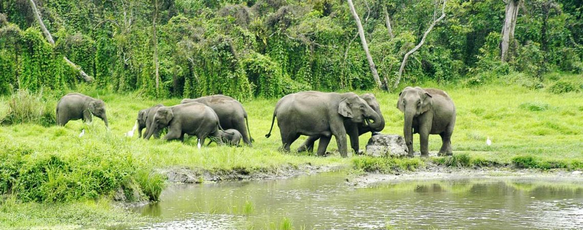
Area : 158 Sq. Km Altitude : 4000 ft above mean sea level Location : Darjeeling District, West Bengal Nearest Village : Sukna (Entry Point in the Sanctuary) Nearest City : Siliguri Distance: 13 Km from Siliguri Best Season : October to May Mahananda Wildlife Sanctuary is a very beautiful and dense forest in North Bengal is located on the foothills of the Himalayas and in between the Teesta and the Mahananda rivers & very close to Siliguri city . The Sanctuary name Mahananda comes from the River Mahananda. Mahananda Wildlife Sanctuary is situated on the bank of the river Mahananda in Darjeeling District of West Bengal. It is covered little more than 158 Square Kilometer forest area and in 1958, it was declared as the Sanctuary to protect Royal Bengal Tiger and Gaur (Indian Bison). Both animal are facing the threat of extinction. It is a perfect place for all those who want to enjoy the beauties of Nature far away from the hustle & activity of the city life. With Mahananda River flowing through it the Sanctuary is bounded by Tista River in the East and Hill Cart Road leading to Darjeeling in the West. The sanctuary reaches up to an high elevation at Latpanchar in Kurseong hill. In the Mahananda Wildlife Sanctuary, mainly three seasons are available, Summer, winter and monsoon. In winter, temperature comes below to 3°C where in summer its goes more than 39°C. But the average temperature ranges from 10°C to 30°C. Mahananda Wildlife Sanctuary belongs in heavy rainfall zone. Where May to October known as rainy session. Average annual rainfall is 300 cm. The Mahananda Wildlife Sanctuary has a versatile type of forests. It varies mainly from riverine forests to dense mixed-wet forest due to the difference altitude. The variation in altitude and forest types helps the existence of a large number of species of mammals, birds and reptiles. Mainly Sal, Shisu, Teack, Jarul forests are available here. There are 330 different types of plantations that have been recorded in the sanctuary. Amongst forest plantation you will see Khair, sisoo, simul and tropical sal forests. Other major plantations includes teak, udal, champ, lali, jarul, gamar, mandane, bamboos, ferns, orchids, sidha etc. There are large grassy areas as well. The lower plains of the forest is the zone for elephant migration. Elephants migrate between Nepal, West Bengal and Assam areas. During winter and monsoon there are more than 150 elephants usually present in the forest. The Mahananda Wildlife Sanctuary, is situated near by the elephant migration route. In the monsoon and also in winter, a large number of migratory elephant shelters here. So, after dark the sanctuary is not safety for visit. The sanctuary has got a tremendous importance in the forest maps of India because of a considerable number of Royal Bengal Tiger. The sanctuary mainly reserved for Royal Bengal Tiger and Gaur (Indian Bison). Except those animal the sanctuary are also famous for chital (spotted deer), barking deer, boar, pangolin, sambar, Rhesus monkey, Himalayan black bear, many species of lesser cat like fishing cat and jungle cat, Himalayan black bear, leopard including clouded leopard, and many other smaller animals like rare mountain goat (Serow), porcupines, wild pig, civets, monitor lizards, snakes, etc. You can also find out some rhesus monkeys in this sanctuary. The Mahananda Wildlife Sanctuary is also a home for a large number of colorful feathered species. The list includes endangered species like fairy-bluebird and Himalayan pied hornbill. Among the others babblers, wagtails, bee-eaters, swallows, sunbirds, rollers, robins, flycatchers, swift, thrush, thrush, drongo, kites, eagles, hornbills, orioles, peacock, fouls, egrets, kingfishers and wood pickers are most important If you are an eco-tourist, check out the Nature Interpretation Centre at Sukna. To help the growth of herbivorous animals several glades have been created at convenient spots inside the sanctuary. These glades have artificial salt licks where the animals are seen coming to taste the salt in the early morning and evening. Several hides and watchtowers have been created near salt licks. An exciting jungle safari in the sanctuary includes the regions of Siliguri- Sukna – Golaghat – Gulma- Laltong and can be a real thrilling experience. Besides the Sanctuary you can find out a natural green carpet on the earth, Gulmarg Tea Estate. The sanctuary has well-laid forest roads, which covers about 50 km. A drive or trek through the forest roads opens up places of magnificent beauty and gives a glimpse of excellent natural and man-made forests. The watchers built beside Gulma River and at Laltong are some ideal places to observe the grazing animals specially elephant, gaur and deer. Watch towers in the Mahananda Wildlife Sanctuary — (1). Laltong Watch Tower: It is located in the bank of Teesta River near Laltong village. This was constructed to monitor the migrated elephant movement. (2). Gulma Watch Tower: An unused railway cabin in the abandoned Gulma Station inside the core area of the sanctuary has been converted into a watchtower. It is ideally located beside the Gulma River and is great for wildlife viewing. (3). Golaghat Watch Tower: It is situated in Golaghat on the bank of Mahananda River, about 5 Km away from Sukna range office. And (4). Laltong Compartment No.9: It is situated near Toribari on right bank of Gulma River constructed to watch wildlife & bird watching. Communication By Road : Mahananda Wildlife Sanctuary is well connected by road with Darjeeling, Siliguri and other towns of North Bengal. Sukna is the gateway to the sanctuary which is located on the Siliguri-Darjeeling highway. It is just 13 Km from the Siliguri and 30 minutes drive distance from Siliguri. By Rail : New Jalpaiguri and Siliguri Railway Station are nearest railway station in Mahananda Wildlife Sanctuary. After arrive in Siliguri or New Jalpaiguri you can share a taxi or hire a private vehicle to reach the Sanctuary. If all condition is in your favor, then you may take a tour with heritage Tray-train from New Jalpaiguri or Siliguri to Sukna with a very reasonable fare. By Air : Nearest airport is Bagdogra. It is a domestic airport under Indian Army. All major air services are available from all over India. Distance between Bagdogra and Siliguri is 13 km. You can find out various vehicles to come in Siliguri, and then follow the above road route
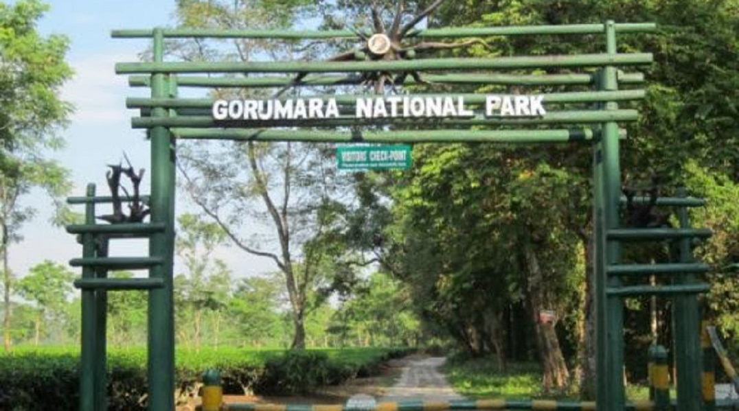
Gorumara National Park complete detail – updated. Geography of Gorumara National Park.
Dominant flora and fauna of Gorumara National Park. How to Reach Gorumara National Park. Gorumara Park located on the bank of rivers Murti and Raidak has vegetation of riverine grasslands interspersed with savannah woodlands. Much of this forest is moist deciduous and sal is the most common and valuable tree. Teak, Simul, Siris, Khair are also found here. The park is breathtaking with its rivers and mountain ranges. The park has been declared as the best among the protected areas in India by the MOEF (Ministry of Environment and Forest) for the year 2009. The park is home to many species flora and fauna. The vegetation here is so thick that sunlight barely reaches down to the forest floor and there are times when it is impossible to see through the thicket…………… Total area of the park is 79.45 Km2. It was established as a National Park in the year of 1992. The park is home to mammal species like One horned rhinoceros, Indian Elephant, Indian Bison, leopard, Deer, Sambar, Monkeys etc. The National park has now become a prime tourist attraction due to the magnificent forests, breathtakingly beautiful landscapes and the presence of the Indian Rhinoceros. National park is an area which is strictly reserved for the betterment of the wildlife & biodiversity, and where activities like developmental, forestry, poaching, hunting and grazing on cultivation are not permitted. Their boundaries are well marked and circumscribed. Gorumara National Park is a beautiful place, located in the Jalpaiguri district of the state of West Bengal. The park is situated in the Terai region of the Himalayan foothills. It is primarily known for its population of Great Indian One horned Rhinoceros. It was established as a National Park in the year of 1992. Total area of the park is 79.45 Km2. Gorumara Park located on the bank of rivers Murti and Raidak has vegetation of riverine grasslands interspersed with savannah woodlands. The park has been declared as the best among the protected areas in India by the MOEF (Ministry of Environment and Forest) for the year 2009. The park is home to many species flora and fauna. The vegetation here is so thick that sunlight barely reaches down to the forest floor and there are times when it is impossible to see through the thicket. The park is home to mammal species like One horned rhinoceros, Indian Elephant, Indian Bison, leopard, Deer, Sambar, Monkeys etc. The park also provide suitable habitat to bird species Indian pied hornbill, Woodpeckers, Sunbird, fly catcher, Minivet, Drongo, Brahminy duck, Pheasants and many more migratory birds. Lataguri a small town adjacent to the park is the entry point. There are watch towers for viewing the animals inside the park. They are Jatraprasad Watch tower (named in memory of a legendary elephant of that name), Rhino observation point in front of the Gorumara forest bungalow, Old Khunia Watch Tower near the Murti forest bungalow and Suksukia Bird watching Point. Rhino observation point is the best place to observe wild animals like rhino, elephant, bison and deer as they regularly come to the salt reservoir just below the tower. The National park has now become a prime tourist attraction due to the magnificent forests, breathtakingly beautiful landscapes and the presence of the Indian Rhinoceros. History Since 1895 it was a Reserve Forest. Bungalow of Park Forest dates to old British Raj period, & has a quite preserved register book from its beginning, which creates for attractive reading. Nevertheless Gorumara is surrounded by several ethnic villages. More than 10,000 resident forest villagers derive their income from sources including employment in forest department activities, ecotourism, etc. Some of the villages are Sarswati, Budhuram, Bichabhanga, Chatua, Kailipur and Murti Forest Village. It was declared a Wildlife Sanctuary in the year of 1949. Gorumara was declared a National Park in the year of 1992. Total area of the park is 79.45 Km2. This area has undulating forests & riverine grasslands, & is famous as the Dooars in West Bengal. Gorumara National Park is situated on the flood plains of the River Murti & River Raidak. The main river of the Gorumara National Park is the river Jaldhaka, a branch of the river Brahmaputra scheme. Geography Gorumara National Park is located in the Jalpaiguri district of the state of West Bengal. The park is situated in the Terai region of the Himalayan foothills. Gorumara Park located on the bank of rivers Murti and Raidak has vegetation of riverine grasslands interspersed with savannah woodlands. The vegetation here is so thick that sunlight barely reaches down to the forest floor and there are times when it is impossible to see through the thicket. Much of this forest is moist deciduous and sal is the most common and valuable tree. Teak, Simul, Siris, Khair are also found here. The park is breathtaking with its rivers and mountain ranges. The arid deciduous jungle terrain mix together with grasslands, docks one of biggest variety of jumbo fauna in West Bengal. The major river of the park is the Jaldhaka River, a tributary of the Brahmaputra river system. In this regard, Gorumara is a significant watershed area between the Ganges and Brahmaputra river systems. The park is very close to Jaldapara National Park and Chapramari Wildlife Reserve. Dominant flora Sal, Bamboo, Teak, Simul, Siris, Khair, and Savanna grass etc. The vegetation here is so thick that sunlight barely reaches down to the forest floor and there are times when it is impossible to see through the thicket. Dominant fauna Mammals – Indian rhinoceros, Gaur, Sloth bear, Deer, Sambar, Asian elephant, Wild boar, Hog deer, Barking deer, Leopard, Tiger, Indian wild dogs, Indian wolves, Giant squirrels, Pygmy Hog, Hispid Hare etc. Birds – Scarlet Minivet, Sunbird, Asian paradise flycatchers, Spangled drongo, Indian hornbill, Woodpeckers, Pheasants, Peafowls, Brahminy duck etc. Reptiles – Indian python, Indian cobra, King cobra, Lizards etc. Other Attractions Ethnic Forest Village Tourism Nature Interpretation Centre Jatraprasad Watch Tower Rhino Observation Point Chandrachur Watch Tower Chukchuki Bird-watching Point Best Time to Visit The best time of the year to visit the Gorumara National Park is between the months of October to May. The park remains closed from 16th June to 15th September. Communication By Air – Nearest airport is Bagdogra airport, about 80 Km from the Gorumara National Park. Bagdogra airport is well connected by road network to Gorumara National Park. By Rail – Nearest railway station is New Maynaguri railway station, about 20 Km from the Gorumara National Park. New Maynaguri railway station is well connected by road network to Gorumara National Park. By Road – Gorumara National Park is well connected to Major Cities and Places by road network. There are a number of government and privately operated vehicles that go to Gorumara National Park at frequent intervals. National Highway 31 which connects Siliguri and Guwahati passes through Lataguri.